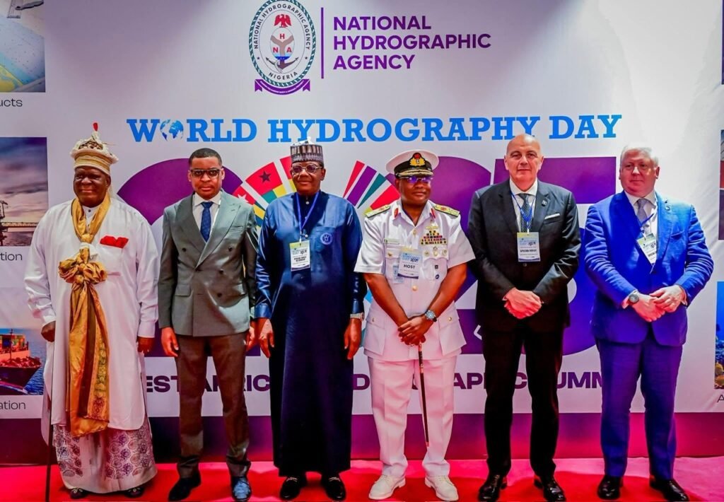
The 2025 edition of World Hydrography Day was celebrated on 21st June in Abuja, under the theme “Seabed Mapping: Enabling Ocean Action.” The event brought together key stakeholders in Nigeria’s maritime, defense, legal, and diplomatic communities, alongside international hydrographic experts, to unveil a groundbreaking survey of Nigeria’s coastal waters with particular attention on the Calabar coastline stretching from Jamestown and beyond.
A key highlight of the occasion was the presentation of three new hydrographic survey mappings, including the detailed charting of the Calabar coastline from Jamestown, designed to support critical marine operations such as navigation safety, offshore oil and wind operations, marine construction, and dredging. These surveys are expected to be central to the realization of the Calabar Deep Seaport, a major infrastructural project for the Gulf of Guinea.
Gracing the occasion was His Eminence, Edidem Ekpo Okon Abasi-Otu V, the Obong of Calabar and Grand Patriarch of the Efik Kingdom, who delivered a powerful keynote address that underscored the cultural, economic, and spiritual relevance of the sea to the Efik people. Representing an ancient coastal civilization with more than six centuries of maritime legacy, the Obong hailed the new hydrographic, geophysical, and geotechnical surveys as a fusion of modern innovation with ancestral memory.
“To chart the sea is, in some sense, to listen again to the voices of history,” the Obong said. “For the Efik people, the ocean has never been a distant or abstract idea. It is the very cradle of our civilization sacred pathways nourished by deities such as Anansa, honored in our songs, our stories, and our lives.”
The new hydrographic features of the Jamestown-Calabar mapping include detailed seabed data critical to maritime navigation, offshore construction, dredging, wind farms, oil exploration, and, notably, the development of the Calabar Deep Seaport. The Obong emphasized that this mapping project would directly assist in accelerating the deep seaport agenda, a major economic initiative for Cross River State and the Gulf of Guinea.
In his address, the Obong called on all stakeholders to align ocean innovation with local knowledge, ocean literacy, and inclusive blue economy practices:
“Let us build a maritime future that is not just data-driven but people-driven; one that respects both the ocean’s ecosystem and its ancestral spirit.”
Dignitaries in attendance included the Deputy Governor of Cross River State, Rt. Hon. Peter Odey, representing Governor Senator Bassey Otu; the Minister of State for Defense; the Attorney General of the Federation; the Hydrographer of the Federation; the Hydrographer of Morocco; and several other foreign envoys and hydrographic experts from across the globe.
The event was hosted by the National Hydrographic Agency, in collaboration with the Nigerian Hydrographic Society, and was hailed as a major stride toward sustainable ocean action, maritime safety, and regional cooperation in West Africa.
As the Calabar Deep Seaport project gains momentum, today’s hydrographic mapping launch serves not only as a technical milestone but also a cultural and spiritual reconnection positioning the Efik Kingdom and Cross River State as vital players in Nigeria’s emerging blue economy.
Follow us on all social media platforms @dailyquery for news and analyses around the globe.
